Ayrshire
Other Ayrshire resources on this site:
There are extracts on Ayrshire in the 1842 Commission reports and also the Mining District Reports. Ayrshire housing is extensively covered in the 1918 Royal Commission Report and information can also be found in the 1875 Notes on Miners Houses. Many Ayrshire places are covered in the 1871 Truck report.
The following parishes have their own pages:
Gazetteer Descriptions
Ordnance Gazetteer of Scotland, Francis H Groome, 1895
Alnwick or Annick Lodge, a collier village in Irvine parish, Ayrshire, 3 miles NE of Irvine town. There is a public school with accommodation for 200 children, which had (1891) an average attendance of 124, and a grant of £116, 2s.
Annbank, a mining
village in the SW of Tarbolton parish, Ayrshire, with a station on
the Ayr and Muirkirk line, 5 miles ENE of Ayr. It has a post office
with money order and savings' bank departments under Tarbolton
Station, a chapel of ease to Tarbolton erected in 1871, and a school
which in 1891 had an average attendance of 370 day and 75 evening
scholars, and received grants of £323, 15s. and £36, 14s.
Pop. (1871) 1151, (1881) 1240, (1891) 1284.
Ardeer, a desolate tract of sand hills, and a seat of extensive industry in Stevenston parish, Ayrshire. The tract lies on the coast between a sinuous line of ancient sea-beach and the present shore, extends from within 1 1/4 mile of Saltcoats to the mouth of Irvine Water, comprises an area of about 1200 acres, is all low and dismal, and lies upon rocks of the Carboniferous formation. Twelve separate seams of coal are beneath it, the uppermost 26 fathoms, the lowermost 129 fathoms, below the surface; and they have, more or less, been mined since about the year 1675. The seat of industry originated in the leasing of the mines about the year 1851; is situated in the south-western part of the tract, 2 miles E of Saltcoats; and has a branch railway, upwards of 1/2 mile long, going into junction with the Kilwinning and Ardrossan section of the Glasgow and South-Western system. Ironworks were erected; several spacious squares of workmen's houses were built near the furnaces; the mining operations were largely extended; chemical works, employing about 200 men and boys, were established; and in the very first years of the enterprise, so many as 850 men, besides a great number of boys, were employed aggregately on the works. The iron-works at once produced between 900 and 1000 tons of pig-iron per week, and at an early date were greatly extended. The output of coal, in one of the first years, was no less than 130,000 tons. The chemical works proved to be uncompensating, and were relinquished; but a dynamite factory (that of Nobel's Company) was established in 1873 (see Stevenston). A schoolhouse was built for the children of the workmen; and a missionary, supported by some members of the Established Church, was engaged for the colliers and furnacemen. The entire seat of industry is called Ardeer Works. An extensive sandstone quarry, one of the most valuable in the West of Scotland, is in Ardeer. The stone abounds in vegetable organic remains; is of a grey tint, susceptible of a fine polish, and very durable; can be raised in blocks of large size; suits well for ornamental portions of public buildings; and is often shipped to Ireland and other places. The post-town of Ardeer is Stevenston.
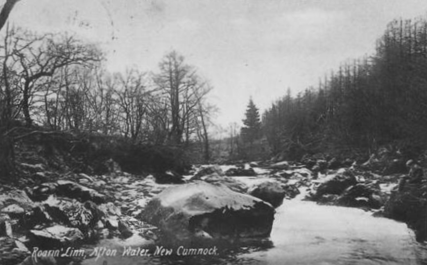
Auldna, a mineral tract, with excellent worked coal, in the upper part of New Cumnock parish, Ayrshire.
Bankhead, a collier village on
the mutual border of Dreghorn and Kilmarnock parishes, Ayrshire, 3
3/4 miles W by N of Kilmarnock town. Pop. (1871) 1170, (1891) 1501.
Bartonholm, a collier hamlet in
Irvine parish, Ayrshire.
Benwhat, a summit in Dalmellington parish, Ayrshire, culminating 2 3/4 miles NNW of the village at 1426 feet above sea-level. Pop of villages (1891) 523.
Burnfoothill, a small town, connected with ironworks, in Dalmellington parish, Ayrshire. Pop. (1871) 1421, (1881) 1690, (1891) 1068.
Camlarg, a collier hamlet in Dalmellington parish, Ayrshire, about 1 mile from Dalmellington village. A coal mine here is nearly 20 fathoms deep; has two seams of coal, respectively 22 and 36 inches thick; and sends up its output by means of a peculiar water-worked contrivance.
Commondyke, a collier hamlet in
Auchinleck parish, Ayrshire, 3 miles NNE of Cumnock. Pop. (1871) 396,
(1881) 438, (1891) 412.
Craigmark, a mining village in Dalmellington parish, Ayrshire, 1 1/4 mile NNW of Dalmellington town. Pop. (1861) 543, (1871) 616, (1881) 383, (1891) 371.
Cronberry, a village of recent origin in Auchinleck parish, Ayrshire, 2 miles NE by N of Lugar. It owes its origin to iron-works of the Eglinton Iron Co., and has a school and a railway station. Pop. (1871) 997, (1881) 799, (1891) 632.
Crosshouse, a village in Kilmaurs parish, Ayrshire, on Carmel Water, 2 1/2 miles W of Kilmarnock, and 1 mile SSW of Crosshouse station. At it is the handsome Established church (1882; 450 sittings) of a quoad sacra parish, formed out of Kilmaurs and Dreghorn, a public school, and a post office under Kilmarnock. Coal has long been wrought in the vicinity, and ironstone during the last 12 or 13 years. Pop. of village (1861) 468, (1871) 713, (1881) 740, (1891) 846; of q.s. Parish (1881) 2424, (1891) 2772.
Doura, a village in Kilwinning parish, Ayrshire, 3 1/4 miles ESE of the town. Extensive coal-works are in its vicinity, and are connected with the Ardrossan branch of the Glasgow and South-Western railway by a single-line railroad.
Drongan, a station on the Ayr and Cumnock section of the Glasgow and South-Western railway, 9 1/2 miles ESE of Ayr. In its vicinity are Drongan House, Drongan colliery, and a tolerably entire but ruined tower, once the residence of a branch of the Crawford family.
Fergushill, a collier village in Kilwinning parish, Ayrshire, 1 3/4 mile E of Kilwinning town. Founded about the year 1835, it has a public school for the children of the colliers and a mission station of the Church of Scotland. Pop. (1861) 279, (1871) 531, (1881) 537.
Gatehead, a collier village in the S of Kilmaurs parish, Ayrshire, near the right bank of the river Irvine, 2 1/2 miles WSW of Kilmarnock. It has a station on the Kilmarnock and Ayr section of the Glasgow and South-Western railway.
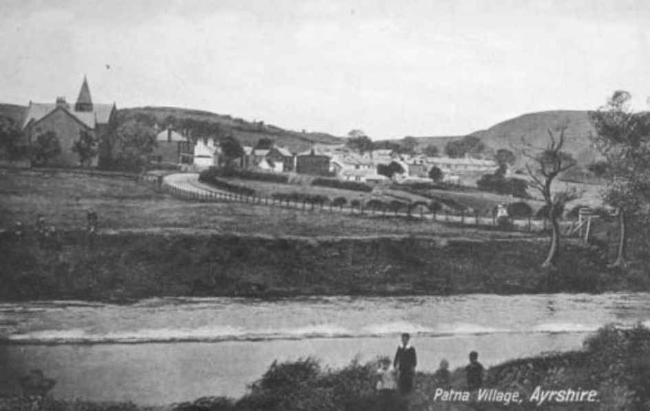
Patna, a village in Straiton and Dalmellington parishes, Ayrshire, on the river Doon, with a station upon the Ayr and Dalmellington branch of the Glasgow and South-Western railway, 10 miles SE of Ayr. Situated in a bleak, confined, tumulated landscape, and forming part of a mineral field rich in coal and ironstone, it has chiefly been built since the commencement of the present century. Its Straiton section consists for the most part of one-story houses, arranged in a main street and a contiguous row; and the inhabitants are chiefly miners or otherwise connected with the mineral traffic. Patna has a post office under Ayr, with money order and savings' bank departments, a handsome granite fountain (1872), an Established church, a U.P. church (1838), and a public school. The Established church was built as a chapel of ease in 1837, and in 1877 was raised to quoad sacra status. Pop. of village (1841) 231, (1861) 470, (1871) 766, (1881) 603, of whom 424 were in Straiton; of q.s. parish (1881) 1179, of whom 213 were in Dalmellington, 412 in Dalrymple, 14 in Kirkmichael, and 540 in Straiton.—Ord. Sur., sh. 14, 1863.